Overview of the Situation
The national meteorological service (DWD) has issued hundreds of weather warnings as a powerful winter storm brings heavy snowfall and freezing rain across large parts of the country. In higher elevations new snowfall of up to 40 cm is expected in the coming days, while lower-lying areas will see smaller amounts but may face serious icing from freezing rain. Authorities are reporting widespread impacts on travel and infrastructure.
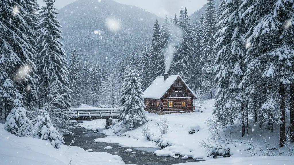
Regional reports indicate particularly strong effects in mountain ranges such as the Erzgebirge, Fichtelgebirge, Harz and the Bavarian Forest. Overnight accumulations of 20–30 cm were observed locally, and forecasts point to up to 40 cm in the worst-affected peaks by Friday. Temperatures are expected to range roughly between -2 °C and +7 °C, a mix that favors both heavy snow in cold pockets and freezing rain where warmer layers move through.
Detailed Forecast and Observations
Current observations and forecasts show a highly variable situation: intense snow showers will continue in the north, east and southeast, while some coastal and lowland areas may see sleet or graupel. Mountainous regions are most at risk of large new snow totals and rapidly changing conditions. Aside from snowfall, freezing rain is creating patches of very dangerous black ice on roads and sidewalks.
| Region | Expected new snow / precipitation | Main hazards |
|---|---|---|
| Erzgebirge & Fichtelgebirge | Locally 20–40 cm | Heavy snow, freezing rain, black ice |
| Harz | Up to 35–40 cm reported in higher parts | Deep snow, road closures, visibility loss |
| Bavarian Forest | 10 cm or more in higher areas | Snow showers, slippery roads |
| Lowlands & urban areas | Few cm of snow, sleet or freezing drizzle | Black ice, commuter delays |
| Coastal areas | Graupel, sleet | Reduced visibility, localized icing |
| Forecasts are evolving; local conditions may change quickly. | ||
Local impacts and regional differences
Impacts differ strongly by elevation and exposure. Highlands and mountains can expect deep snow, reduced visibility and avalanche risk, while urban and lowland regions face slick roads, public transport delays and local power outages. Coastal and northern areas may experience graupel and mixed precipitation rather than heavy snow.
Warnings, Authorities and Expert Advice
The DWD has explicitly warned that drivers and pedestrians should prepare for slippery conditions. Meteorologists note that isolated snow showers in the eastern half can bring a few centimeters of new snow, while mountains may see 10 cm or more in individual events. With hundreds of warnings issued at higher alert levels, authorities are urging caution and preparation.
Recommended measures from transport and rescue authorities
- Fit winter tires and check tread depth before driving; where conditions demand it, use chains in high elevations.
- Reduce speed, increase following distance and expect longer travel times.
- Avoid unnecessary journeys; stay at home when local authorities advise doing so.
- Prepare for possible power outages and delays to public transport and freight services.
- Heed avalanche bulletins in mountain areas—rescue organizations have warned of avalanche risk up to level 3 in some slopes.
Practical Safety Tips for Residents and Travelers
- Check the latest weather warnings before you leave and plan to change or postpone trips if major warnings are in effect.
- If you must drive, equip your vehicle with winter tires, spare warm clothing, a charged phone, flashlight, shovel, ice scraper and, in mountainous areas, tire chains.
- Drive slowly and defensively: braking distances increase on snow and ice, and freezing rain can create sudden black ice.
- Keep an emergency kit and at least 72 hours of essentials at home in case of temporary isolation or power cuts: water, food, medicines, warm blankets.
- Follow instructions from local authorities and emergency services and report dangerous situations such as fallen power lines or stranded vehicles.
Simple precautions—good winter tires, lower speeds, and keeping an emergency kit—substantially reduce risk. For mountain travel, additional equipment and local knowledge are essential because avalanche risk and rapidly changing weather can make conditions dangerous within hours.
What to Expect Next and How to Stay Updated
The storm is expected to continue in pulses, so heavy snowfall and freezing precipitation can reoccur. That can lead to longer-lasting disruptions: traffic chaos, large delays, and localized power outages remain possible. Residents should follow official warnings and be prepared for conditions to escalate quickly.
Quick checklist
- Stay informed via official weather warnings and local announcements.
- Avoid non-essential travel during high-alert periods.
- Equip your vehicle for winter conditions and keep essentials on hand.
- Help vulnerable neighbors where safe to do so and report emergencies promptly.
- Expect changing forecasts and be ready to adapt plans at short notice.
