Cold snap arrives: quick summary
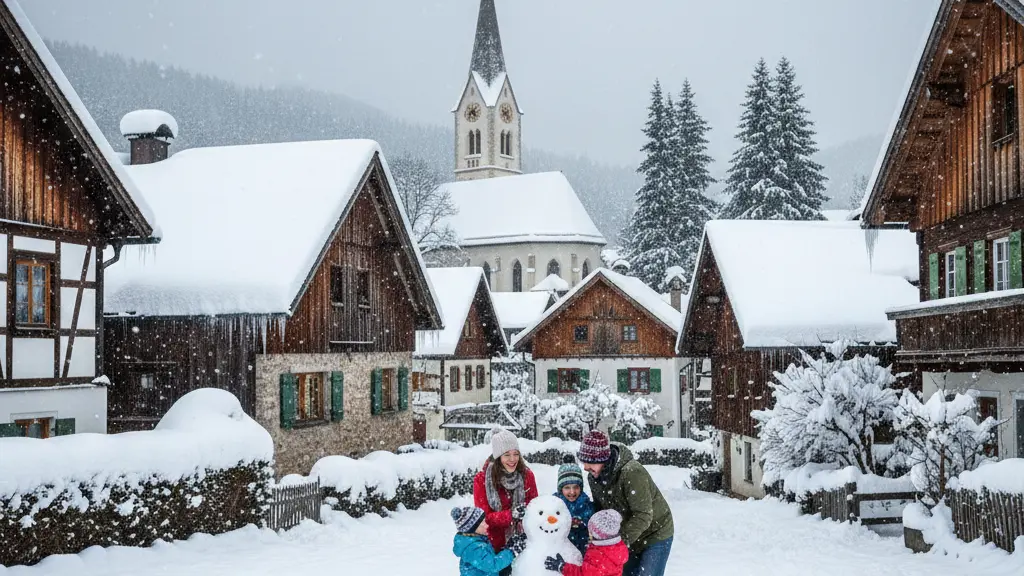
A powerful polar front is moving into Germany in mid-March 2026, bringing a sharp cold snap. After several days with springlike highs near 20 °C, temperatures will fall quickly to around 5–10 °C by day and down to about -10 °C at night in the coldest areas. The change is abrupt and will be accompanied by showers, hail, graupel and snowfall, especially at higher elevations.
Meteorologists warn that the shift can occur within a few days: ‘Within a few days it goes from up to 20 °C back to 5–10 °C,’ noted experts. The Alps could see more than 50 cm of new snow with extreme avalanche danger. Frost will threaten flowering plants and fruit trees, and road conditions may become hazardous—drivers are advised to use winter tyres and prepare for icy or snow-covered roads.
Detailed forecast: temperature, snow and wind
Temperature changes
The cold air comes from northern and eastern directions and will cause a rapid temperature drop across large parts of the country. Daytime highs fall from values close to 20 °C in some places to single digits, while nights may see widespread frost.
- Typical daytime temperatures during the cold snap: 5–10 °C in many areas.
- Nighttime lows: down to -10 °C in inland and sheltered valleys.
- Some regions may still reach higher values (+10–+16 °C) in brief breaks, reflecting an unstable pattern.
Precipitation and snow
Precipitation will fall as rain, sleet or snow depending on altitude and the intensity of showers. Higher terrain is at greatest risk of heavy snowfall, while lowlands may see snow mainly in strong showers or on cold ground.
- Snow likely from about 400–600 m and above; heavy showers can bring snow even lower.
- In the Alps, new snowfall may exceed 50 cm in places, increasing avalanche risk.
- Snow to about 300 m is possible in some areas during the most unstable phases.
Wind and storm impacts
The polar front will be energetic, producing strong gusts and frequent frontal waves. Coastal and exposed areas should prepare for blustery conditions alongside wintry precipitation.
- Stormy gusts may reach up to 110 km/h in affected areas.
- Wind-driven snow can reduce visibility and increase drifting on roads and passes.
Impacts and warnings
Roads, travel and safety
Drivers should expect sudden changes in road conditions. Patches of ice, slush and compacted snow can appear quickly, especially during overnight hours and where spray freezes. Authorities and experts emphasize the need for winter equipment and cautious driving.
- Use winter tyres where road conditions may be icy or snowy.
- Allow extra travel time and reduce speed on wet, icy or snow-covered roads.
- Keep an emergency kit, warm clothing and a charged phone when traveling in affected regions.
Alps and avalanche danger
Heavy snowfall in the Alps raises the risk of avalanches to extreme levels in places. Rapid accumulation of new snow on existing layers can create unstable snowpacks. Mountain rescue services and local avalanche bulletins should be consulted before any alpine activity.
- Anticipate over 50 cm of new snow in some alpine zones.
- Avoid backcountry travel without current avalanche information and proper equipment.
- Ski areas may close or limit operations during extreme conditions.
Agriculture, gardens and fruit trees
The late frost is a significant threat to blossoming trees and early crops. Farmers, gardeners and orchard owners should prepare for possible damage and localized crop losses where blossoms are exposed.
- Frost protection measures are recommended for orchards and sensitive plants.
- Cover young plants or move container plants indoors or to sheltered locations if possible.
- Expect potential yield impacts where blossoms or young fruit are affected by subzero temperatures.
How to prepare: practical advice
Preparation reduces risk. Simple steps for households, drivers and outdoor workers can limit damage and keep people safer during the cold snap and snowy periods.
- Check tyre condition and consider fitting winter tyres before travel in snowy or icy conditions.
- Monitor weather forecasts and local warnings; adjust plans for outdoor activities and travel.
- Protect vulnerable plants and fruit trees with covers, frost fans or other frost-protection methods where available.
- Prepare an emergency kit for vehicles: warm blankets, torch, shovel, ice scraper, food and water.
- If travelling through mountain passes, carry chains or use routes that are kept clear and check avalanche bulletins.
Meteorological background and outlook
The pattern behind this cold snap is a disturbed large-scale circulation with blocking highs and an active polar front. Cold-air troughs and energetic waves along that front are pushing arctic or subarctic air into central Europe. This unstable setup can bring frequent, changeable weather through Easter, with wintry conditions even at relatively low elevations.
Climate context and short-term outlook
March 2026 so far has been warmer than the long-term average by about 3.3 °C (mean around +6.8 °C). The ongoing cold snap will reduce that anomaly and bring higher precipitation around mid-March. Expect a mix of wintry and milder spells ahead: snow to around 300 m in some phases, gusts up to 110 km/h, and temperature swings between about +2 and +16 °C depending on timing and location.
