1. Winter storm shifts south — clear but very cold conditions in the north
In recent days a powerful winter storm brought heavy snow, strong winds and extreme cold across large parts of the country, especially the north, which disrupted travel and rail services. The storm, referred to in many forecasts as “ELLI”, has shifted its center toward the south. As the low moves away, weather conditions are calming from the north while snowfall becomes more concentrated over central and southern regions.
Regional differences and immediate hazards
Regional reports reflect that the weather differs sharply: the south faces ongoing snow and slippery conditions driven by a cool west to northwest flow, while the north is dominated by clear skies and severe frost. Even on bright, sunny days this combination creates treacherous residual ice, freezing rime and over-frozen wet surfaces that pose hazards for roads, walkways and transport infrastructure.
Meteorologists describe the pattern as classic post-passage weather: Arctic cold air floods in behind the departing low, producing very frosty conditions, frequent sunshine and much drier weather in the north. Forecasts indicate that by Sunday most of the country will experience dry, sunny and frosty winter weather, while snowfall gradually retreats over Baden-Württemberg, Bavaria and the Alpine foothills. Northern areas will see persistent subzero temperatures, often below -10 °C in places.
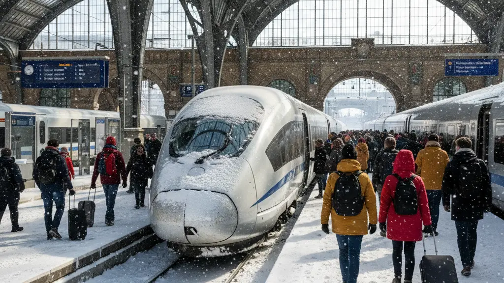
2. Impact on long-distance rail services
The storm caused widespread disruption to long-distance rail travel: snow drifts, fallen trees and iced overhead wires resulted in cancellations and significant delays, and key north–south routes were partly or completely halted during the peak of the event. With the precipitation center now moving south, conditions in the north are improving and the rail network is in a better position for recovery work.
Why services can start again
As the snow focus shifts into southern and Alpine regions and the north dries out, maintenance crews can clear tracks, de-ice points and switches, and inspect and secure overhead lines more effectively. These tasks are essential before long-distance trains can return to regular schedules. Because the pressure on northern infrastructure eases first, operators plan a staged resumption of long-distance services where conditions are safe.
Remaining operational risks
Even while services restart, risks remain. Where fresh snow falls in the south or where a warm front brings snow that changes to freezing rain, sections of the network may face new ice formation on tracks and overhead equipment. Operators and infrastructure teams therefore expect localized delays and the possibility of further cancellations until the warming and thawing trend becomes established.
3. Travel advice and operator measures
Transport authorities and weather services advise travelers to stay flexible. The national rail operator has introduced temporary ticket flexibility: passengers with tickets for heavily affected days can delay journeys and certain ticket restrictions are being relaxed. Travelers are urged to check the current status of long-distance and regional services before departure and to favor travel windows that are likely to be calmer, such as Sunday midday or the period after any dangerous warm front has passed.
Practical recommendations before you travel
- Check the current train status and timetables shortly before leaving.
- Allow extra travel time and expect potential delays or altered routes.
- If possible, postpone non-essential trips to more stable weather windows.
- Make use of the operator’s temporary ticket flexibility where offered.
- Dress warmly and bring charged mobile devices in case of longer waits.
4. Short-term outlook: warming front, freezing rain and midweek thaw
Meteorological guidance points to a critical transition: a warm front arriving from the west in the night to Monday will first produce snow and then, over subzero surfaces, change to freezing rain. This change-over is particularly dangerous because rain that freezes on contact can create rapid and widespread black ice and cause fresh operational problems for road and rail networks.
Expected timeline
- Sunday: Mostly dry, sunny and very cold in the north; snow concentrates in central and southern regions.
- Night to Monday: Warm front advances from the west with snow initially, then a transition to freezing rain where the ground remains cold — heightened risk of dangerous glaze ice.
- Monday: Significant glatteis (black ice) risk in western and southwestern areas; possible further travel disruptions.
- Midweek: Precipitation field weakens; western and southwestern temperatures rise toward +5 to +10 °C (locally higher), leading to rapid thaw and improving conditions for stable long-distance rail operations.
5. Safety tips for passengers and final notes
Overall, sources paint a consistent picture: the severe winter storm is shifting south while northern areas remain frosty and clear. The next 24 to 48 hours are critical because the change from clear cold to milder, wetter air can bring freezing rain and fresh ice. By midweek, especially in the west and southwest, a thaw is expected that should ease conditions and help long-distance rail services stabilize.
Top safety tips
- Always check live service updates for long-distance and regional trains before leaving.
- Use offered ticket flexibility to reschedule if your trip coincides with highly affected times.
- Allow extra time at stations and be cautious on platforms and pathways—black ice can be invisible.
- Carry warm clothing and essentials in case of unexpected waiting periods.
- Avoid driving in areas with warnings for freezing rain; consider public transport only if services are running and safe.
